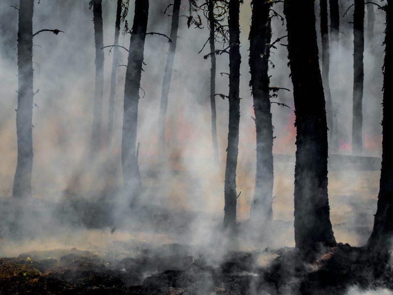
A recent study published in Nature Ecology & Evolution shows that the number and intensity of the most extreme wildfires on Earth have doubled over the past 20 years. Similar results are found in the recent European Climate Risk Assessment, to which several authors from ACCREU contributed. The European Climate Risk Assessment confirms the significant impacts that the increasing number of wildfires have on ecosystems, human settlements, health, critical infrastructure, tourism, the economy, and also on carbon storage.
In ACCREU, the Technical University of Denmark (DTU) together with partners from the International Institute for Applied Systems Analysis (IIASA) are developing a new and fully probabilistic approach for assessing wildfire risks under different climatic, land use and adaptation scenarios.
While wildfires are clearly exacerbated by prolonged periods of dry and hot spells, humans generally play the main role in their ignition. As a result, it is inherently difficult to assign a proper risk (ignition probability) to a certain location. For emergency preparedness and climate change risk analyses, indicator-based approaches that consider only environmental drivers are therefore typically used as means of representing wildfire risks. This includes the broadly used Fire Weather Index (FWI), which is an integral part of the European Forest Fire Information System (EFFIS) and frequently used by meteorologists and climate modelers. For local assessments of wildfire risks, dedicated ignition models trained on local observations of weather and proxies for human activities have been developed in some locations to underpin identification of locations with high risks of wildfires considering both human and environmental factors. However, such models do not exist broadly or are not coupled to climate change projections. Similar, existing risk management practices tend to favor a more qualitative approach, where detailed fire spread models are forced by pre-selected sets of ignition points and weather conditions from expert elicitation, e.g. informed by historical fires.
To assess the climate change risk from wildfires in Europe, ACCREU pilots a novelly integrated framework for estimating the wildfire risk to ecosystems, biodiversity and socio-economic sectors across different spatial scales. The framework interlinks a complete modelling chain: (a) a stochastic wildfire ignition model considering proxies for human activities and environmental factors (i.e. FWI) at high resolution; (b) regional climate projections at 3-hourly resolution downscaling different Shared Socioeconomic Pathways (SSP-RCP) via CMIP6 global climate models, e.g. EUROCORDEX; (c) terrain-following downscaling of wind fields (5-12 km resolution) to the inherent resolution of the EU Digital Elevation Model (30-m); (d) facilities for incorporating CORINE Land Cover from Copernicus as well as modelled land cover (change) from IIASA’s Global Biosphere Management Model; (e) the ForeFire high-resolution, open-source wildfire spread model.
Using this modelling system, ACCREU generates a large ensemble of probabilistic fire spread simulations and associated burnt areas and timelines that are directly derived from different combinations of land cover (e.g. GLOBIOM or CORINE) and climate projections using different regional climate models and scenarios, and based on the estimated daily ignition probability. These novel fire spread simulations will for example be used as input to IIASA’s Integrated model for BiodIversity distribution projectionS to assess the impact of wildfires on biodiversity for different climatic futures. They will also be used to test different adaptation scenarios for case studies in Sweden and in the Campania region of Italy, respectively.
Figure 1 (c) depicts the estimated wildfire ignition probability for the Campania region, Italy, for a summer day with very high FWI. The ignition model is here estimated from historical data for (2000-2020) using a Random Forest (RF) machine learning model using a combination of hydro-meteorological reanalysis and socio-economic data. The model shown has an accuracy of >80%. As land use proxies corresponding to human activities, we use road and powerline data sourced from OpenStreetMap, while the nighttime lights data are obtained from NASA. The Fire Weather Index for 2000-2020 used for training the RF ignition model was calculated from ERA5-land reanalysis downloaded from the Copernicus Data Store (Figure 1(a)). For comparison, Figure 1(b) shows analogous FWI data from the Copernicus Emergency Management System (CEMS) based on the coarser ERA5 reanalysis. As indicated, while ERA5 and ERA5-land yield comparable results, the local effects of the higher resolution stand out, and are important for accurate simulation of fire evolution, considering in particular local wind fields.
The first scientific output from the ACCREU integrated wildfire modelling framework will be presented in the latter part of 2024 and early 2025.
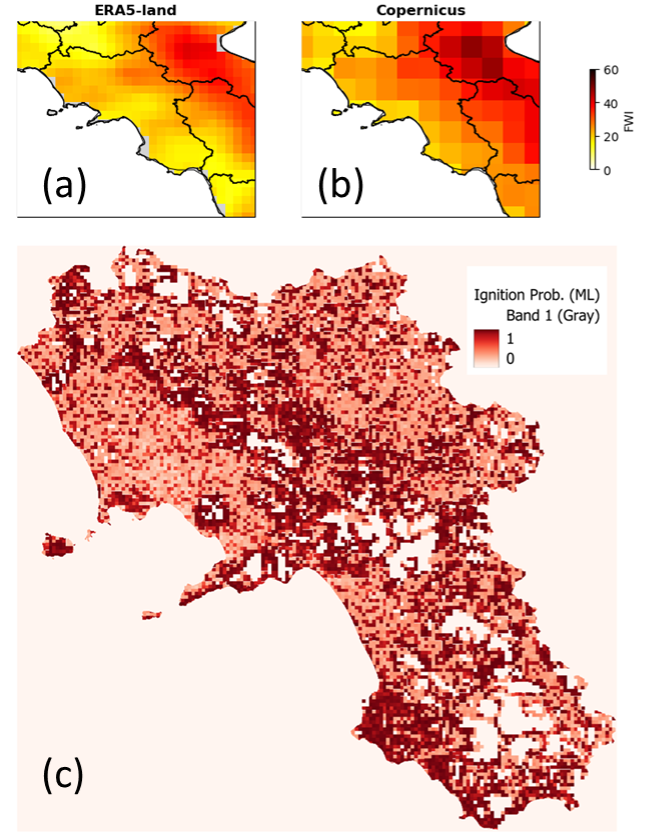
Figure 1. (a) Fire Weather Index (FWI) averaged over June-July-August (JJA) for the period 2000-2020 based on ERA5-land for Campania in Italy. (b) Same as (a) except data was extracted from the Copernicus Emergency Management System (CEMS) and based on ERA5. © The estimated ignition probability (0-1) for a summer day in August with high FWI based on a random forest machine learning model trained on historical data (FWI, road density, power line density, night lights) for the period 2000-2020.